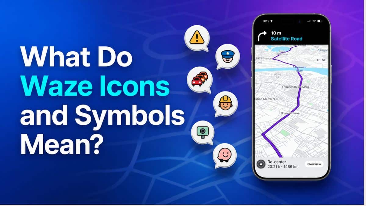
Waze packs a lot of information into very small icons, and unlike most navigation apps, a good chunk of what you see comes from other drivers reporting things in real time. A little face wearing a hard hat means roadwork ahead. A car surrounded by red dots means a traffic jam. A pin shaped like a balloon is your destination.
These icons are not just decoration. They tell you where police are parked, whether the road ahead is closed, how bad traffic really is, and even what mood the driver next to you is broadcasting to the world. Ignoring them means missing information that can save you time, a ticket, or a wrong turn.
This guide covers every major Waze icon and symbol organized by where you will actually see it in the app, so you can glance at your screen and know exactly what it means.
Waze Home Screen Icons
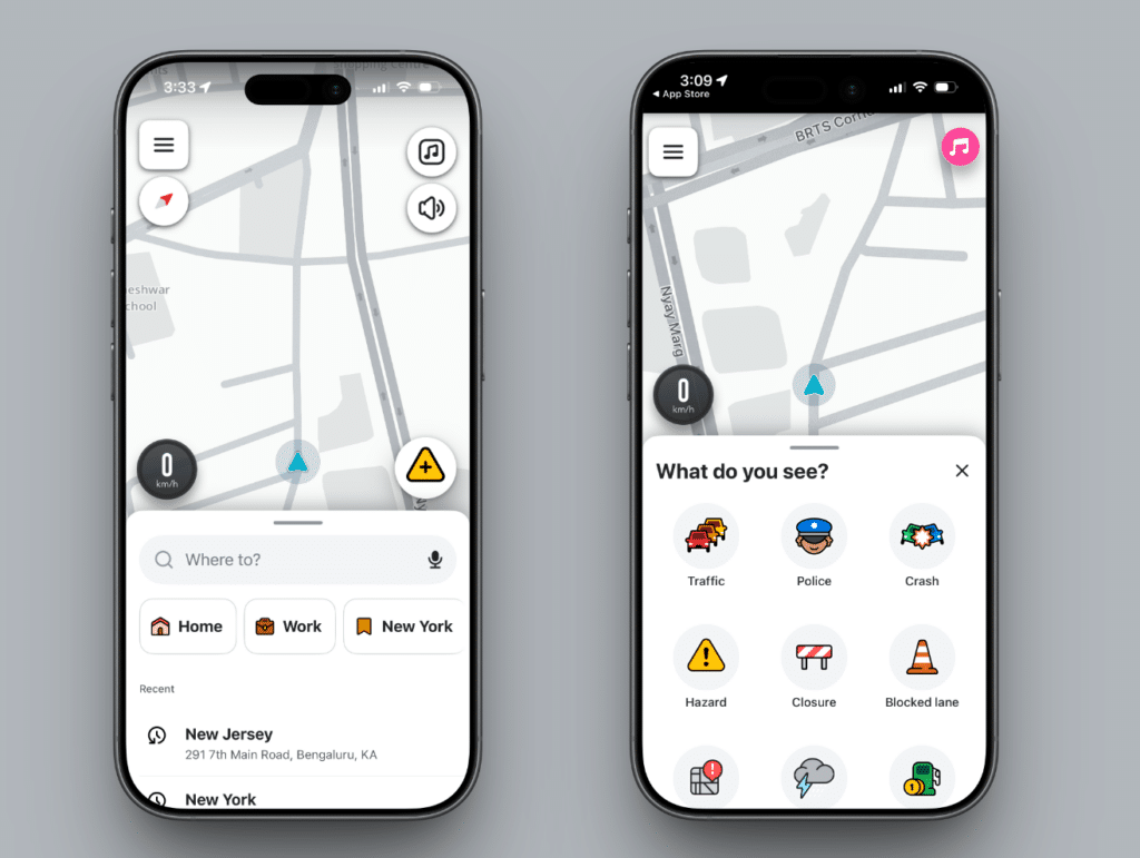
Before you even start driving, Waze’s main screen has a handful of icons you will use constantly. This is the screen you land on every time you open the app.
- “Where to?” search bar: The bar across the bottom where you type or say a destination. Tapping the microphone icon inside it opens voice search.
- Microphone icon: Opens voice search. As of the July 2026 Gemini update, this icon also triggers natural language search. You can ask something like “find a coffee shop that’s open right now” or “find parking near Grand Mall” and Waze returns a list of matching results instead of a single address match. Currently rolling out to the Waze beta community globally on Android and iOS.
- Yellow triangle (report) icon: The main reporting button. Tapping it opens a quick menu to report police, a crash, a blocked lane, bad weather, and other hazards.
- Layers or map icon: Toggles what appears on the map, including traffic, gas prices, and alerts, and switches between standard and satellite-style views on some versions.
- Settings (gear) icon: Opens Waze’s settings menu for navigation preferences, voice prompts, account settings, and the newer Less Chatty mode.
- Sound or mute icon: Mutes or unmutes Waze’s spoken turn-by-turn and alert prompts without pausing navigation.
Navigation Icons
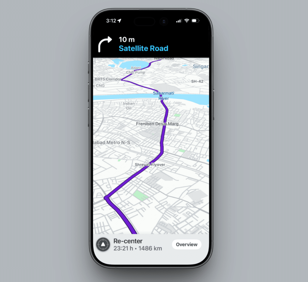
Once you start driving, the map view changes to show your live position, your route, and a strip of live information. These icons appear specifically while you are navigating.
- Blue arrow: Your current position and direction of travel on the map. It moves in real time as you drive.
- Red balloon or pin: Your destination. The balloon shape makes it easy to spot against the other markers on the map.
- Speedometer: Shows your current speed. It turns red when you are driving above the posted limit, which is Waze’s visual cue to slow down before a spoken alert fires.
- Speed limit sign icon: A small road-sign graphic showing the posted limit for the road you are on. It updates automatically as limits change along your route.
- ETA or arrival bar: The bar at the bottom of the driving screen showing your estimated arrival time, remaining distance, and drive duration.
- Send ETA icon: A share-style icon in the route info panel that lets you text your live ETA to a contact directly from the app.
- Sound or Less Chatty toggle: Toggling Less Chatty mode, added in the July 2026 update and rolling out globally on Android and iOS, reduces how often Waze interrupts music or podcasts with voice prompts. It still calls out hazards and turns.
Road Color Coding
Waze uses the color of the roads themselves as a symbol system, which is especially useful for understanding what kind of road you are being routed onto.
| Color | Road Type |
|---|---|
| Purple | Freeways and expressways |
| Blue | Major highways |
| Green | Smaller or minor highways |
| Yellow | Main or primary streets |
| White | Local or residential roads |
| Grey | Ramps or short connector roads |
| Olive | Private roads |
| Brown | Unpaved or dirt roads |
Real-Time Traffic and Hazard Report Icons
This is where Waze earns its reputation. The icons placed on the map by other drivers in the last few seconds or minutes warn you about what is ahead. Report icons fade out automatically over time if other drivers do not confirm them, so a stale report usually disappears from the map on its own within a couple of hours.
| Icon | What It Means |
|---|---|
| Police cap face | Police reported nearby — A checkpoint, patrol car, or speed trap |
| Yellow hazard triangle | A general road hazard — could be debris, a stalled vehicle, or roadkill |
| Pothole symbol | A reported pothole on the road ahead |
| Hard hat face | Ongoing construction or roadwork on that stretch |
| Red and white barricade | The road is closed to traffic |
| Two cars with impact lines | A reported accident on the road ahead |
| Row of red or pink cars | A traffic jam, with color intensity from pink to red showing how slow traffic is moving |
| Rain or cloud symbol | Reported poor weather conditions — rain, fog, or similar — affecting visibility or road safety |
Speed and Red-Light Camera Icons
These are technically hazard icons, but they are common and specific enough to call out separately. Waze has also expanded what drivers can report in this category.
- Speed camera icon: Marks a fixed or mobile speed camera. You will also get a voice alert as you approach, unless you were already driving at or under the limit.
- Red light camera icon: Marks an intersection with a red-light camera. These alerts are on by default on both Android and iPhone and can be turned off under Settings, then Camera Alerts.
- New camera-type reports: As of the latest update, Waze has expanded the ability to report additional hazards beyond the original speed and red-light camera set, including speed bumps, toll booths, sharp curves, upcoming speed-limit changes, and emergency vehicles. Each has its own small icon on the map. This rollout is still reaching different regions at different times.
Nearby Places Icons
Along your route or around your current location, Waze shows small icons for common stops.
- Gas pump icon: Nearby gas stations, often with prices shown alongside on supported routes. The new Gemini voice search can also surface these conversationally; saying “find me a gas station nearby with the lowest prices” returns a browsable list.
- Fork and knife icon: Nearby restaurants and food options.
- P icon: Marks where you parked, or shows nearby parking availability depending on context.
- Coffee cup icon: Nearby coffee shops. Like the food and gas icons, these are what Waze’s Gemini search can surface when you ask things like “find a coffee shop that’s open right now.”
Wazer Avatar and Mood Icons
Every Waze user is represented on the map by a small car icon with a face, called a Mood. These are purely cosmetic and carry no navigation or traffic data.
| Mood | Appearance |
|---|---|
| Happy (default) | Pink smiling face |
| Chill | Orange face wearing sunglasses |
| Angry or Furious | Red face |
| Sad | Blue face with a tear |
| Funny | Yellow laughing face |
| Zen | Purple meditating face |
| Wild | Helmeted face for motorcycle-style driving |
Waze offers over 100 Moods in total, including limited-time and unlockable ones accessible from your profile settings. They are a personalization feature, not a status indicator. Someone driving with a Furious Mood is not reporting a road hazard; they are just venting at traffic.
New Icons From Waze’s Gemini Update
Waze rolled out Gemini-powered features on July 13, 2026, and several of them come with new icons or change what an existing icon does. These are actively rolling out, and you may not have all of them yet depending on your region and whether you are on the standard app or the beta.
- Conversational reporting bubble: Appears when you speak a map correction naturally, for example, saying “the road is closed here” instead of manually selecting a report type. Waze routes the report to local map editors for verification before it appears on the map for other drivers. This expanded in the July update to cover map corrections like outdated addresses, not just traffic incidents.
- Motorcycle Mode icon: A new mode icon in route settings that tailors routing and hazard alerts specifically for two-wheeled vehicles. It flags potholes, speed bumps, raised crosswalks, shoulder endings, and narrow bridges. It also incorporates motorcycle-specific shortcuts and road restrictions that car navigation ignores. Rolling out first in Argentina, Brazil, Colombia, Malaysia, Mexico, Peru, and the Philippines, with more regions to follow.
- Personalized route label: A small label on suggested routes that indicates Waze picked that path based on your driving history, for example if you consistently prefer highways over local streets. It is optional and can be turned off in settings.
Signing Off
Waze’s icons look cryptic the first time you see them, but once you know the system, they become fast glance-and-go information built by millions of other drivers. Every symbol on the map is either the app itself telling you something about the road, or another driver who passed through a minute ago leaving a note for everyone behind them.
The hard hat face icon means there is reported construction or roadwork on that section of road. It was placed there by another driver and will fade out if no one confirms it within a couple of hours.
Your speedometer turns red when you are exceeding the posted speed limit for the road you are on. It is Waze’s visual cue to slow down, usually appearing just before a spoken alert fires.
Purple roads are freeways. Blue roads are major highways. Green roads are smaller highways. Yellow roads are main streets. White roads are local residential streets. Grey roads are ramps and connectors. Olive roads are private. Brown roads are unpaved.
Moods are the face icons that represent your avatar on the map and other drivers’ avatars on yours. They are purely cosmetic and carry no traffic or navigation data. The default is a pink happy face, but over 100 options are available through your profile settings.
The yellow triangle on the home screen is the reporting button. Tapping it lets you quickly report police, a crash, a blocked lane, bad weather, and other hazards. A yellow triangle on the map itself is a general hazard report placed by another driver.
Less Chatty mode is a new toggle added in the July 2026 Gemini update that reduces how often Waze speaks voice prompts while you are listening to music or a podcast. It still alerts you to turns and hazards but keeps interruptions to a minimum. It is rolling out globally on Android and iOS.
Motorcycle Mode is a new routing option that tailors your navigation for two-wheeled vehicles. It factors in motorcycle-specific shortcuts, road restrictions that cars can use but bikes cannot in some markets, and hazards particularly relevant to riders including potholes, speed bumps, raised crosswalks, shoulder endings, and narrow bridges. It launched in Argentina, Brazil, Colombia, Malaysia, Mexico, Peru, and the Philippines with more countries expected to follow.
You might also like: